To the Lake and Back
Arguing that the urban periphery is a network of landscapes, not the leftover of a city.
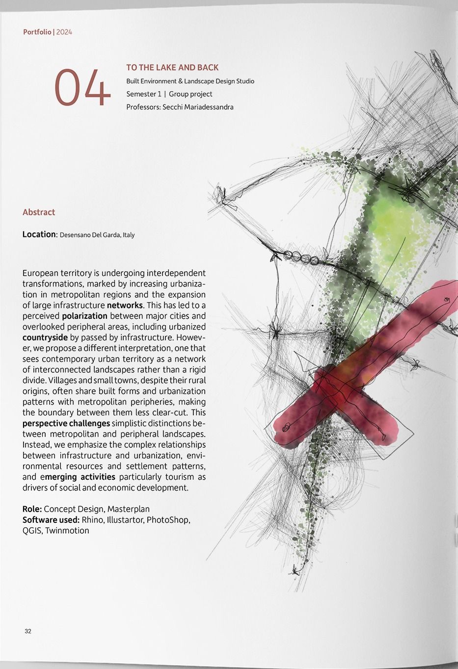
European territory is being reshaped by two things at once: urbanisation concentrating in metropolitan regions, and large infrastructure networks expanding across everything else. The usual reading of that is a polarisation: the major cities on one side, the overlooked periphery and the bypassed countryside on the other.
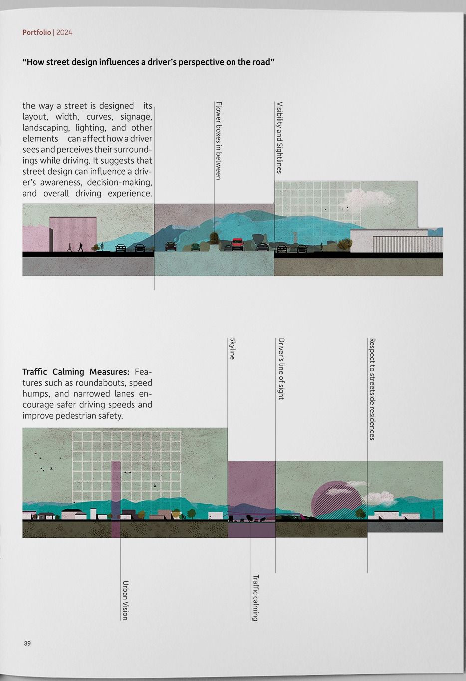
The project argues against the reading. Villages and small towns, whatever their rural origins, often share built forms and urbanisation patterns with metropolitan peripheries; the boundary is far less clear-cut than the diagram suggests. What is actually there is a network of interconnected landscapes, and the interesting relationships are between infrastructure, environmental resources, settlement patterns and emerging activities, tourism among them, that drive social and economic change.
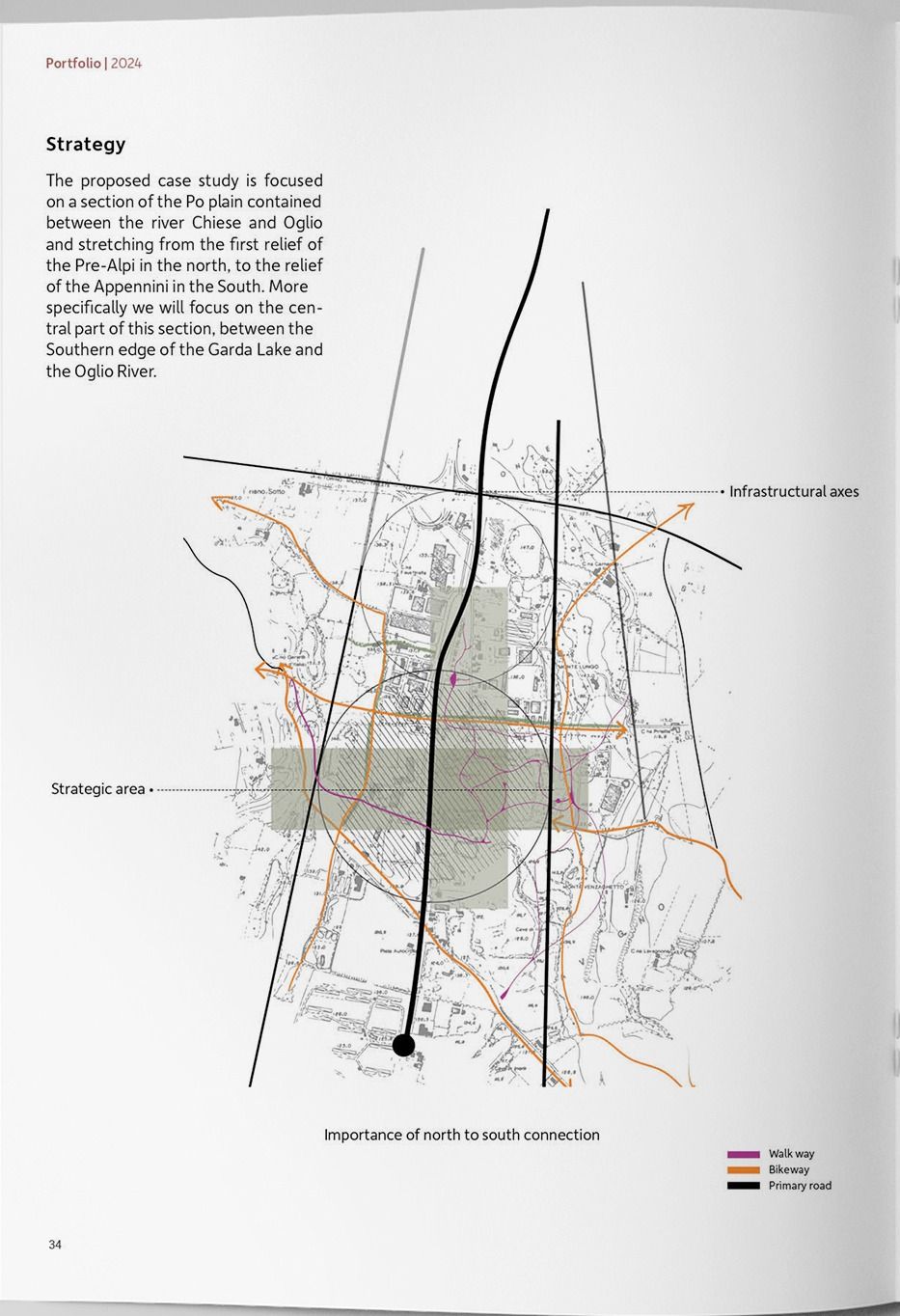
The case study runs across the Po plain between the Chiese and the Oglio, from the first relief of the Pre-Alps in the north to the Apennines in the south, focusing on the stretch between the southern edge of Lake Garda and the Oglio river.
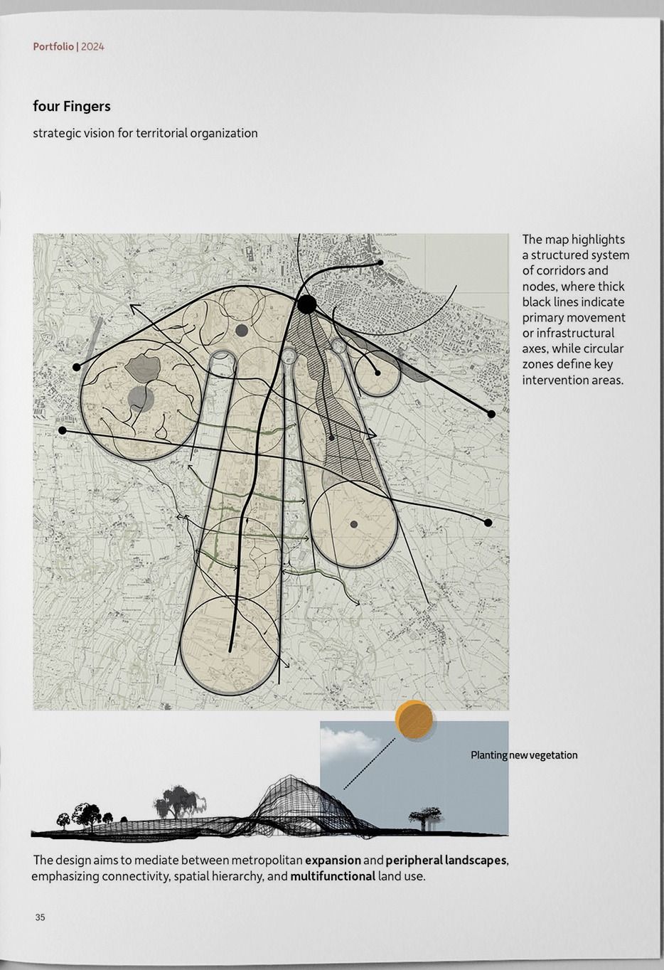
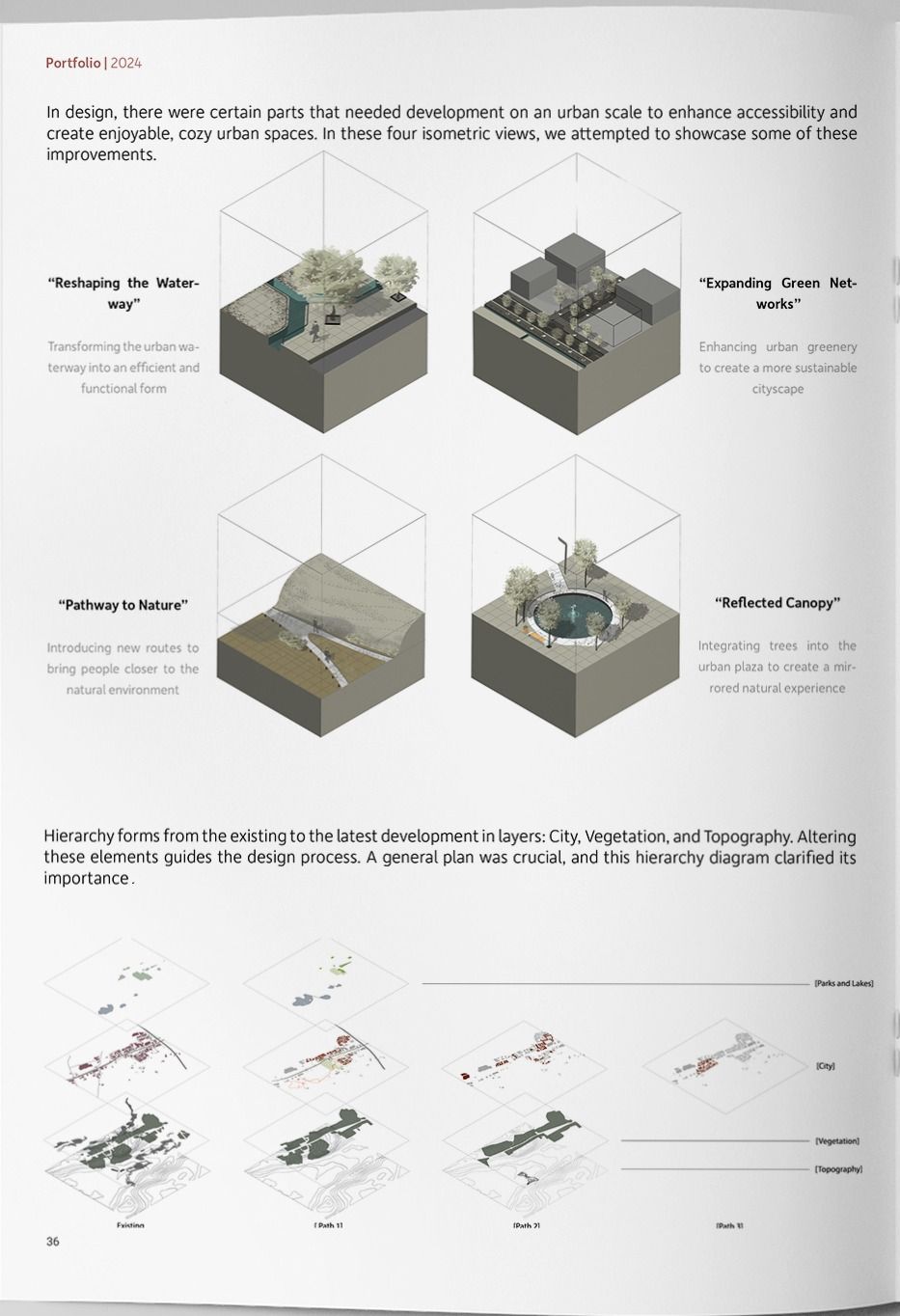
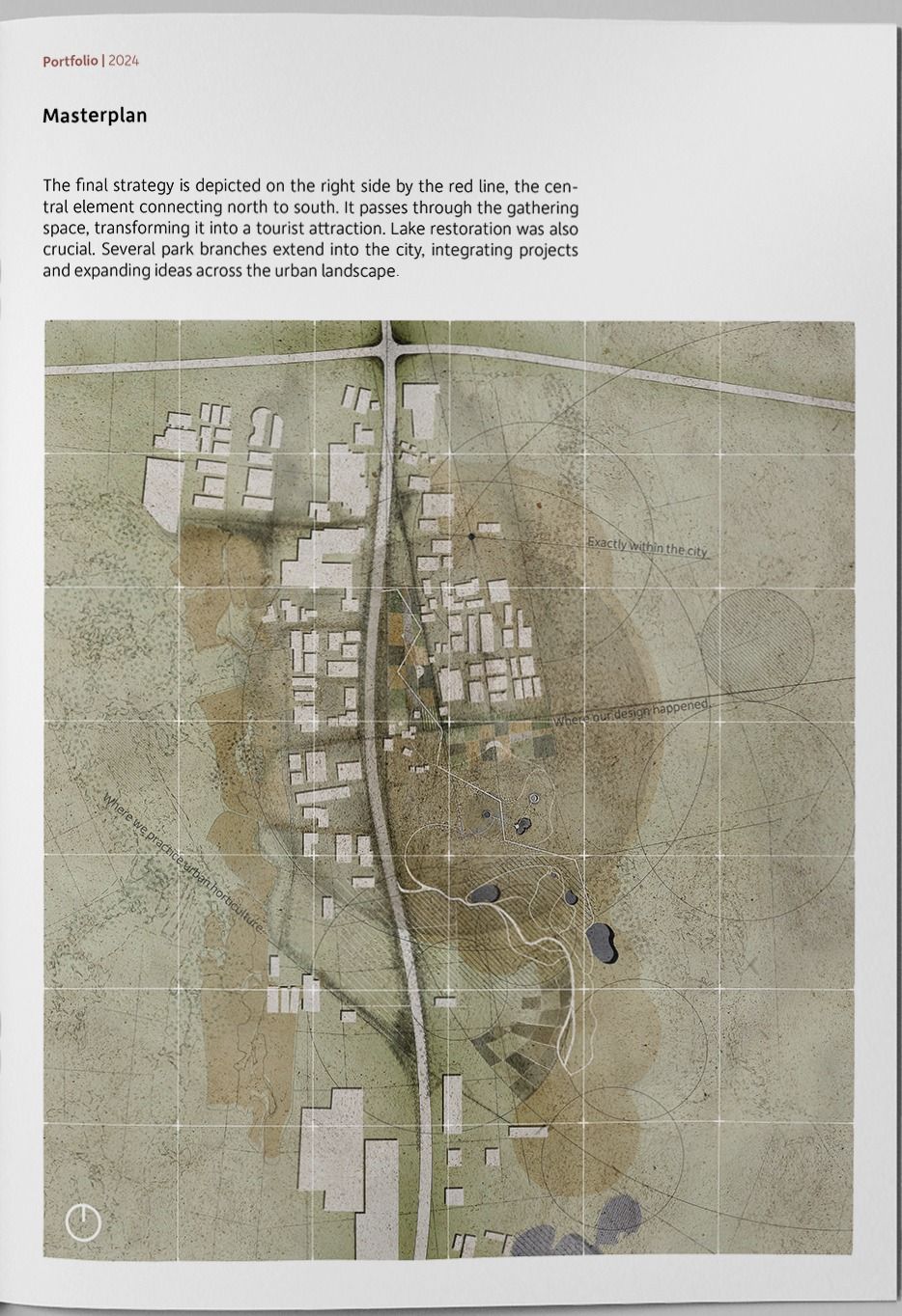
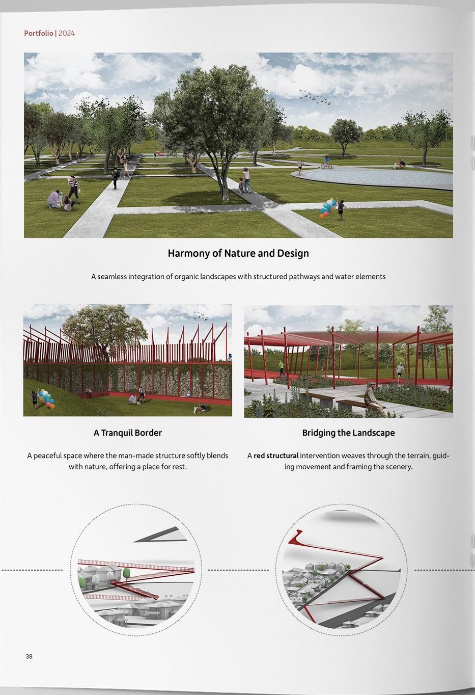
The strategy organises the territory around four fingers: a structure of corridors and nodes where movement axes and key intervention areas are set against each other. Four urban-scale moves carry it into the town: reshaping the waterway, expanding green networks, a pathway to nature, and a reflected canopy that brings trees into the plaza. The final line runs north to south through the gathering space, and the lake is restored.
- Desenzano del Garda, Italy
- 2023
- Built Environment & Landscape Design Studio · Semester 1
- Secchi Mariadessandra
- Group project
- Concept design · Masterplan
- Rhino · Illustrator · Photoshop · QGIS · Twinmotion
Academic work. My contribution is listed above; the rest of the studio group did the rest.