Hidden Illusion of Bygone Landscape
Four paths to an Apennine peak, in a place the twentieth century emptied out.
Since the beginning of the twentieth century, and with rising intensity after the Second World War, large parts of the Apennines have lost their population. Cultivated land and productive woods were abandoned and the forest came back on its own. The rural economies that held the place together (agriculture, livestock, crafts) declined, and only seasonal recreation in the highlands partly replaced them.
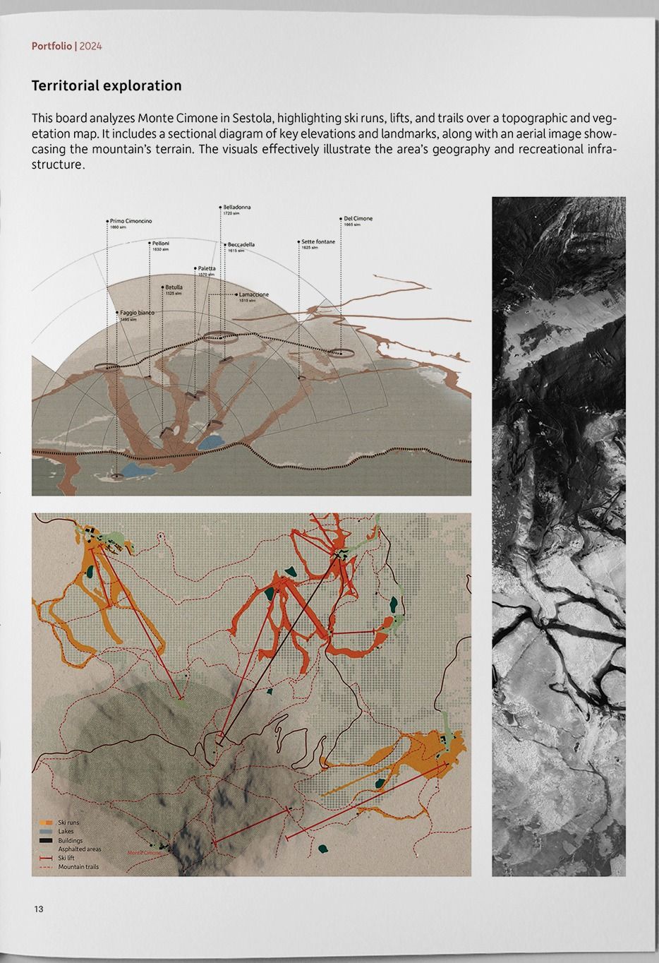
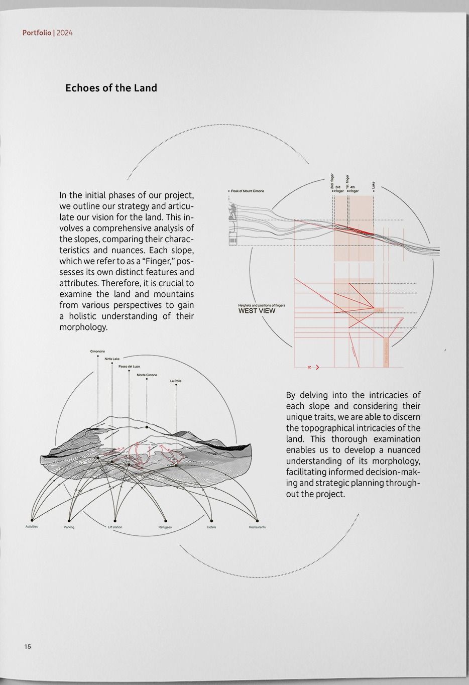
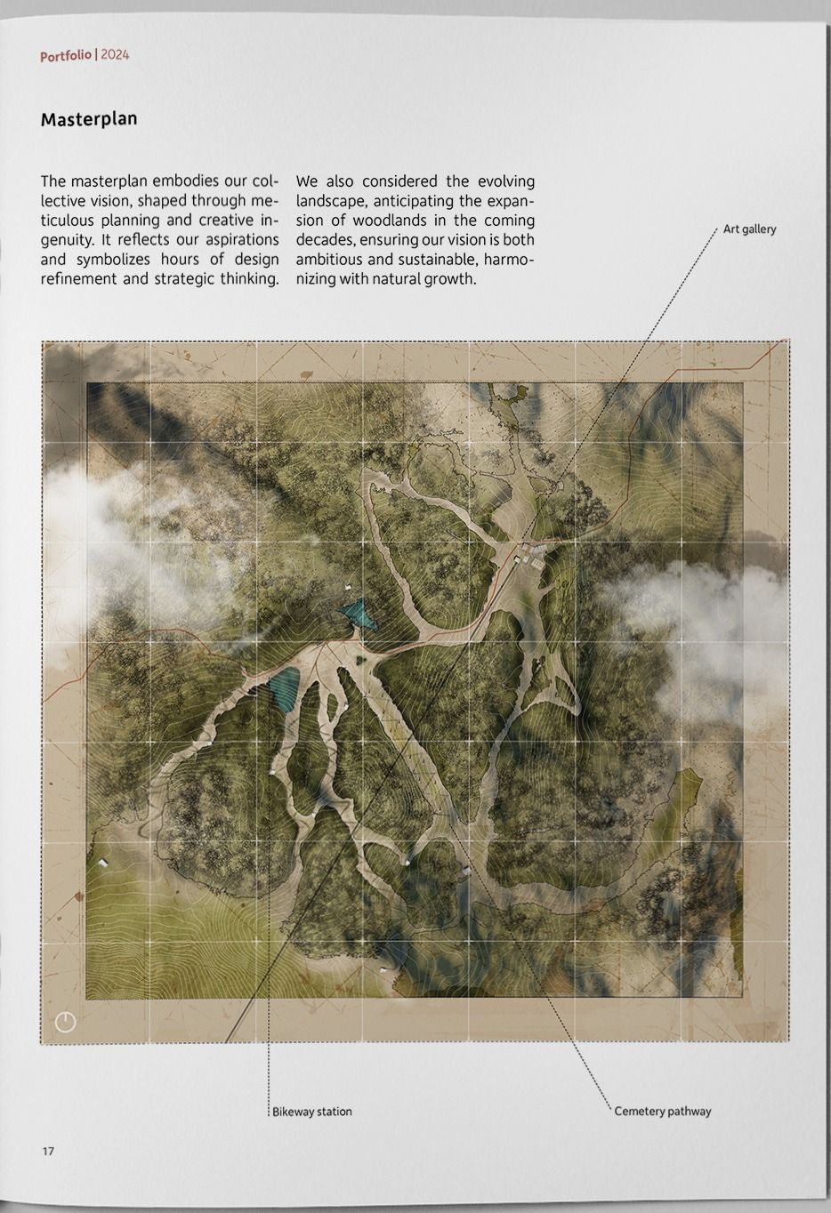
The project reads Monte Cimone through what is left: ski runs, lifts and trails laid over topography and vegetation, and a mountain whose morphology is best understood by comparing its slopes against each other.
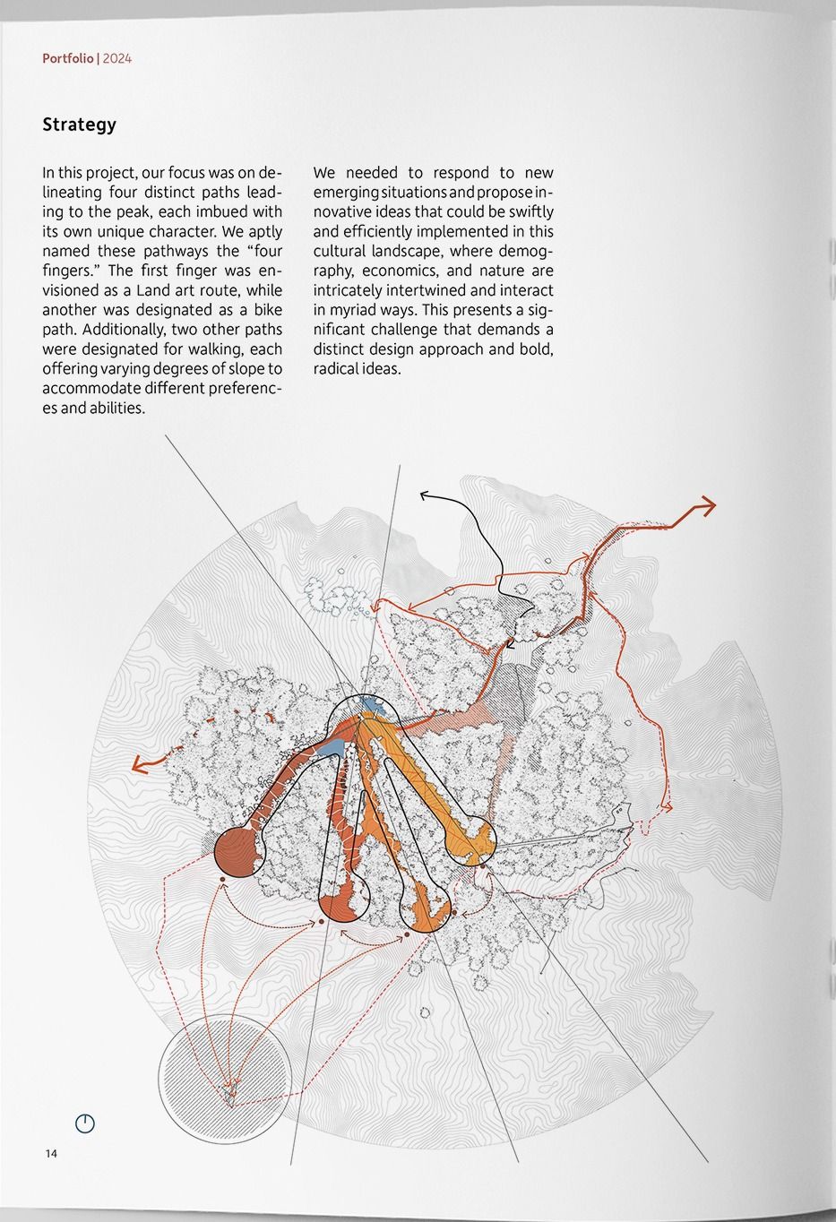
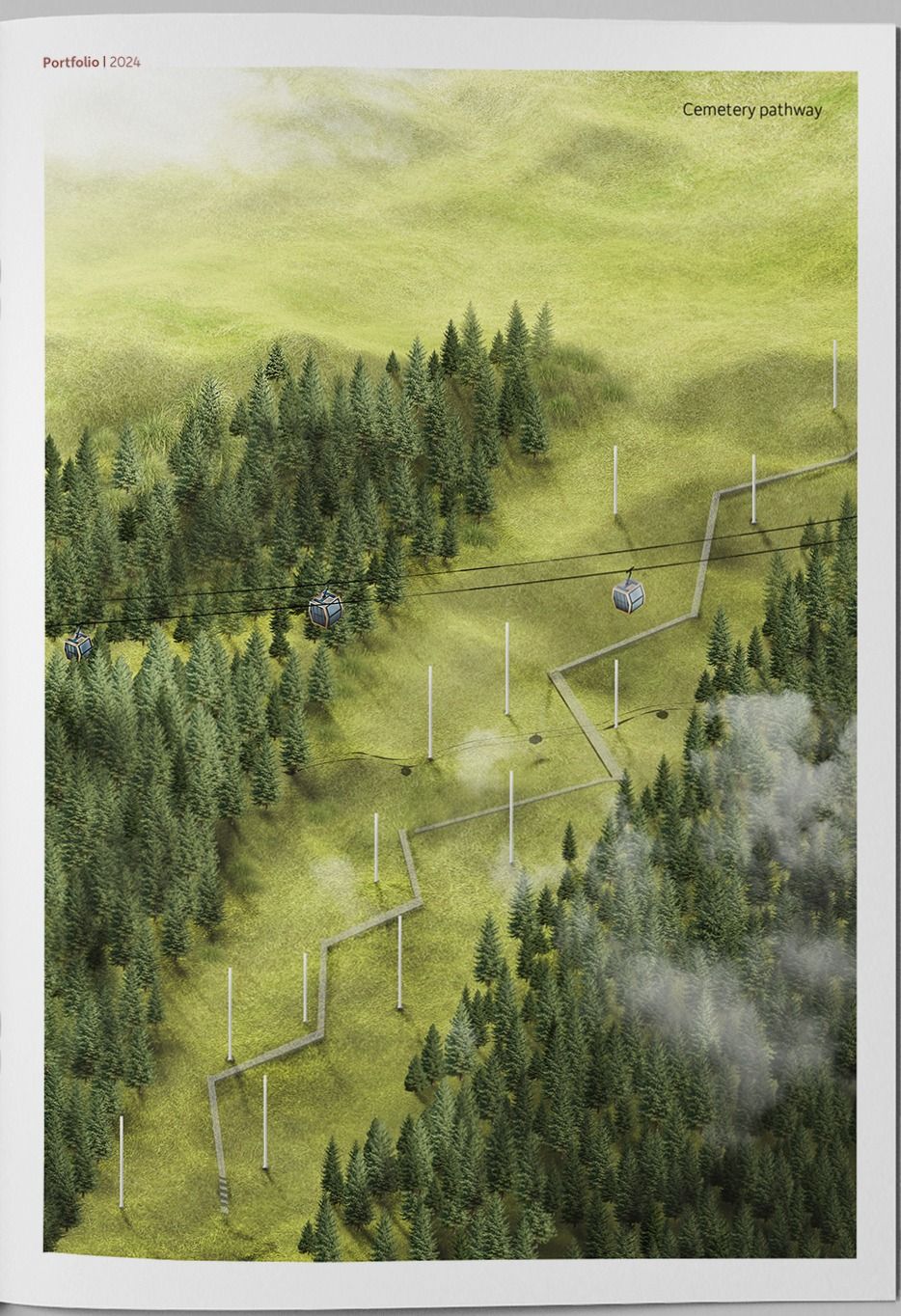
The strategy delineates four distinct paths to the peak, each with its own character, and we called them the four fingers. One is a land-art route. One is a bike path. Two are walking routes at different gradients, so the climb can be chosen rather than endured.
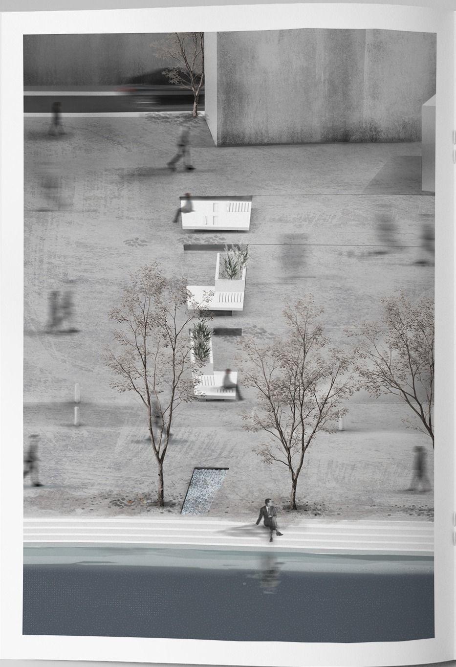
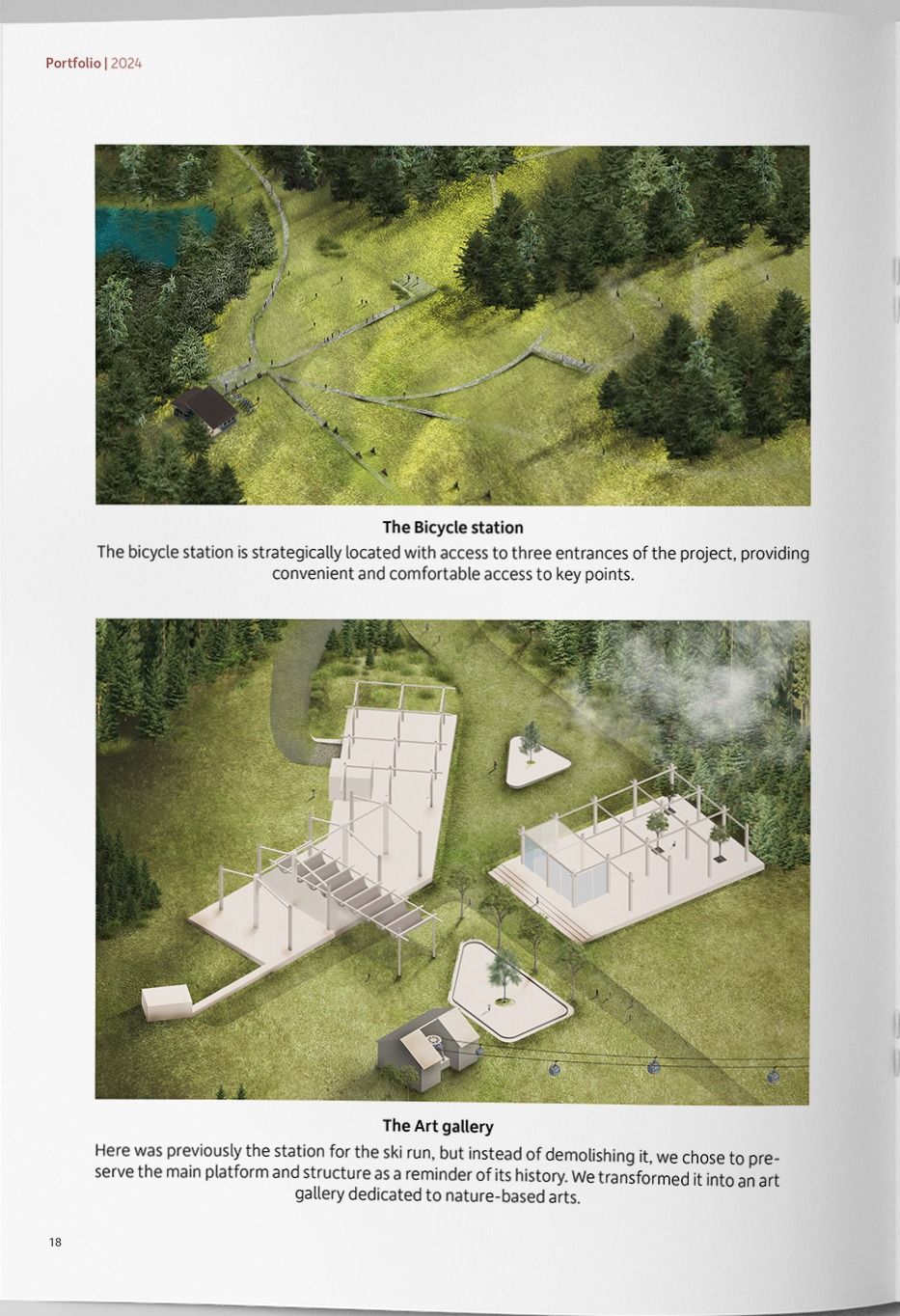
The built elements are deliberately light. Shelters were templated to behave differently at different heights while keeping the least possible contact with the ground, for better flexibility for capturing light, and less damage to what is already growing there. Where the ski run once had its station, we kept the platform and structure instead of demolishing it, and turned it into a gallery for nature-based art.
- Monte Cimone, Sestola, Italy
- 2024
- Built Environment & Landscape Design Studio · Semester 2
- Federico Zanfi
- Group project
- Concept design · Masterplan · Render
- Rhino · Illustrator · Photoshop · QGIS · Twinmotion
Academic work. My contribution is listed above; the rest of the studio group did the rest.